Animating Environmental Change
Global Seasons (credit: Wikicomons)
Re-photography captures images taken at the same geographic location over a time-line years. When the images are animated, they produce a Graphic Interchange Format, of GIF more commonly, a GIF. This media technology is especially useful for observing environmental change.
Using remote-sensing imagery, Google Earth created GIF's to illustrate how much three environments have changed in only 34 years, 1984-2012. The examples include: Alaska's Columbia Glacier in retreat; the Brazilian state of Para being deforested; and Central Asia's Aral Sea disappearing. One GIF demonstrates the impact of climate change on glacial landscapes; another the impact of illegal logging and land clearing; and the last the consequences of political ignorance of the environmental parameters necessary to sustain an ancient water source.
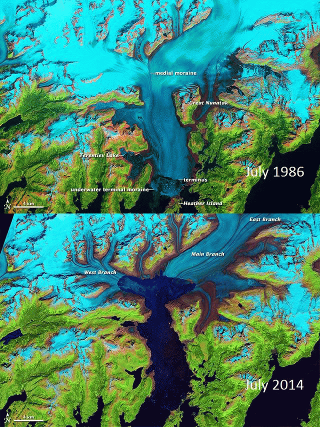
Columbia Glacier retreat:
According to NASA, this Alaskan glacier is one of the fastest to have loose its ice mass over the past 34 years, nearly 50% of its once thickness. Glacial ice deficits are calculated using 'mass balance' or the difference between winter snows and summer melting. When glaciers loose more ice in the summer than gained in the winter it is in retreat. Glacial retreat is now widely documented from Greenland to the Alps, from Patagonia to the Andes, the Tibetan Plateau, as well as Alaska. The consequences of all this ice loss have yet to be fully measured.

Columbia Glacier retreat timeline, 1986, 1999, & 2017 (credit: Landsat/NASA) 1986-2014 (credit: Landsat/Earth Observatory)
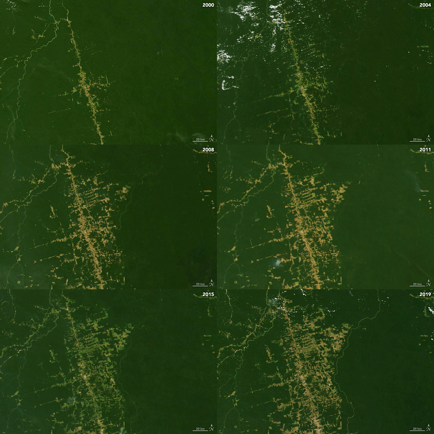
Amazonian deforestation:
over the course of the past 34 years, the Amazon rainforest has lost nearly 20% of its original coverage. This has happened through a combination of forest clearing for agricultural production, illegal logging, and weakly enforced laws. Rondonia state has experienced some of the highest levels of tropical deforestation in Brazil as observed by NASA satellites:

Amazonian deforestation, 2000-1999 (credit: NASA/Landsat-8)
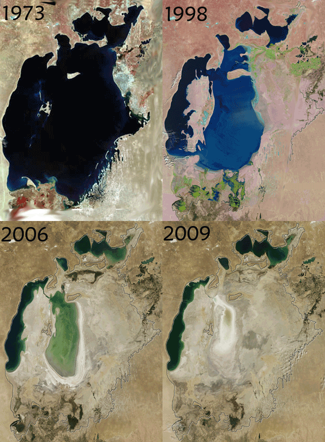
Aral Sea evaporation: The Aral Sea in Central Asia was once one of the five largest lakes in the world. Politically ill-conceived water diversion projects in the mid-20th Century for cotton production diverted run-off from the Pamir Mountains and the lake just dried up. Salt build-up from over-irrigation in the dry, desert environment caused agricultural yields to drop steeply and a fishery that once sustained an economy, disappeared along with the water.

Aral Sea Disappears, 1973-2009 (credit: NASA)
It has been said: "a picture is worth 1000 words". These environmental GIF's almost tell an entire story but each with the same ending: "nature always bats last" and this is usually viewed only in hindsight!
WHB