California Faultlines
Continental plates map (credit: Scripps Institute of Oceanography)
It is not often that you can observe where plate tectonics unfold. The globe-spanning process, created and still carries the continents on gigantic plates of the Earth's mantle. The plates fold under or slide past each other mostly beneath the oceans. In a few places, a plate's faultlines are located on land. Iceland sits on the middle of the Mid-Atlantic ridge and is spreading apart from the inside of the island outwards with the two sections moving in opposite directions. An video explains the basics of this process.
In California, the Pacific Plate and the North American Plate are grinding past each other on the West Coast. The friction of their slow but constant movement creates earthquakes as pressure is abruptly released from deep underground. Los Angeles and San Francisco sit on the edge of the continent and the San Andres Fault runs near both cities. It was in 1906 that San Francisco dramatically experienced the deadly consequences of what can happen when the fault shifts.
The San Andres can be seen from space by Earth-monitoring satellites. It was photographed in the natural color of Point Reyes National Seashore. A rift in the coastal landscape, where the two plates are grinding against each other in separate directions, is clearly visible at Tomales Bay north of San Francisco. As the rift continues to grow, from further plate movements, the bay will eventually become open to the ocean at its southern end. The western section of the coast will eventually become an island. A similar outcome awaits a portion of Southern California that will include the Baja peninsula. That section will become a second island carried along on Pacific Plate as it moves northwards. The process is predicted to take between 3-5 million years for both rifts to become islands. WHB
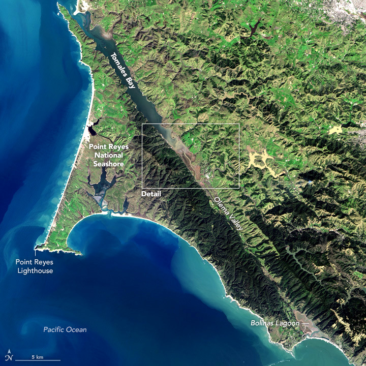
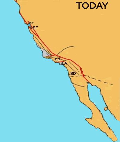
Pacific plate rift, Pt. Reyes-Tomales Bay, CA (credit: Landsat-8) & CA-Baja island development (credit: Gipher)