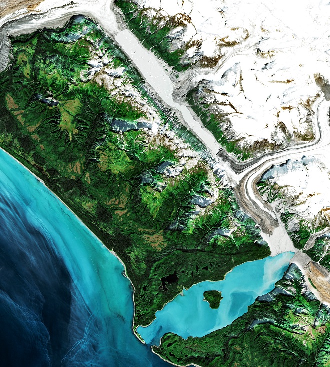
Once There Was A Glacier, Now There Is A Lake
Re-photography, Desolation Valley, Alaska, 1986- 2013 (credit:(NASA/Landsat)
In 1986, Desolation Valley in Glacier Bay National Park was entirely filled with ice to a bay on the Gulf of Alaska. In the past 35 years, the situation has radically changed and significant loss of the glacier has occurred. According to measurements of satellite data by researchers with the American Geophysical Union (AGU):
"by 2010, the southern half of the valley had opened and the terminus of Desolation Glacier and Lituya Glacier (red arrows), representing a 3.3 mile section of glacier, had been lost. In 2013, the northern half of the valley still ice-filled by the Desloation-Fairweather Glacier was breaking up but by 2014 it had completely broken up. By 2016, the collapse was total and the new terminus (yellow arrow) represented nearly a 3.5 mile retreat since 2010, a total loss of 4 square miles of ice.
Since that earlier report, the glacier has continued its relentless decline including a outburst of ice, water, mud, and debris in the Summer of 2020. According to the National Park Service:
a massive outburst flood traveled underneath the Lituya Glacier, emerging from under its south end onto the gravel delta that now separates the glacier from Lituya Bay (in a Park posting) The lake level dropped at least 200 feet, implying a total flood volume of about half a cubic kilometer of water. For comparison, that is nearly an hour’s worth of flow from the world’s most voluminous river: the Amazon.
Glacial outburst Glacier Bay NP, July-September 2020 (credit: NASA/Landsat)
Alaska and the rest of the Arctic are experiencing some of the fastest rates of temperature increase in the world due to climate change. Glaciers and permafrost are particularly sensitive to temperature and indicators of the dynamic changes. Re-photography and satellite infrared imagery are powerful tools to document the rate and level of these changes as Desolation Valley has shown.
WHB