Temperature Anomalies, Then & Now
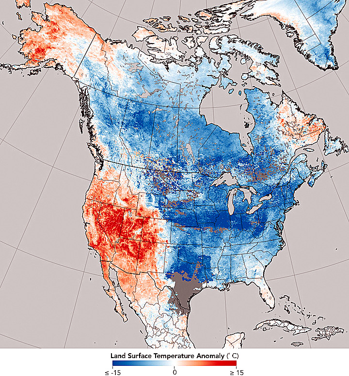
North American temperate anomalies, 12-2017 to 1-2018 (credit: MODIS)
Maps can often inform more in an image than in many words. Eartly in 2018, NASA released a composite image of temperature measurements gathered by the Earth monitoring Terra satellite program. Strong differences in surface temperatures (an anomaly) appear as tones of red or blue. Grade school kids could tell something is different between various regions of North America. The temperature anomalies were substantial and obvious. According to NASA at the time:
"the map of North America shows a weather reality—when a cold snap hits one region, warmth often bakes another one. A giant bend (meander) in the jet stream is the thread connecting warm weather west of the Rockies with the deep chill east of them. The crest of the jet stream, pushed far towards Alaska in December pulling warm tropical air along with it, while the other side of the wave, a trough, slid deep into the eastern USA, bringing dense, cold Arctic air south with it. The Rocky Mountains boxed-in the cold, densest air, serving as a barrier between the cold and warm air masses."
A similar weather pattern is currently developing and could bring severe weather to parts of North America once again this year. The weather monitoring service, Severe Weather Europe, is forecasting a winter storm from a mass of cold, Arctic, air stretching down the center of the North American continent which could bring cold and snow into parts of Europe over the holidays as well. This larger temperature anomaly is showing a pattern similar to the map the Terra satellite produced two years earlier. Heavy rain and extreme weather along the Arctic front are likely to also stretch into the south and southwestern US.
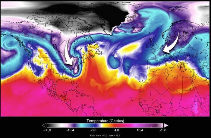
Temperature anomalies North America, Europe 12-20-2020 (credit: Severe Weather Europe)
This is not a "pretty picture" but has been seen before.
WHB