A Polar Desert Island
Glaciers draining off ice caps, peaks, and ridgelines, Ellesmere Island (credit: Terra program)
Ellesmere is an island in the polar desert of the Canadian Arctic. It is beautiful, remote, and weird.
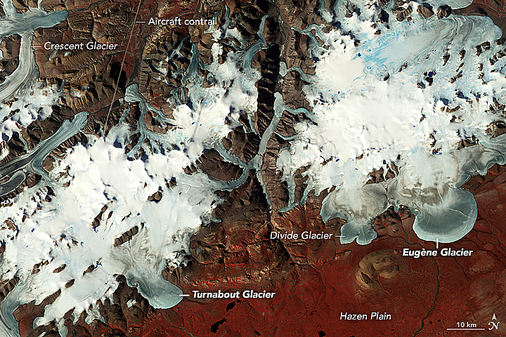
NASA's Terra Earth monitoring satellite carries an Advanced Spaceborne Thermal Emissions & Reflection Radiometer, ASTER for short, that was developed at the Jet Propulsion Laboratory in Califonria. The radar instrument produced detailed images of Turnabout Glacier, a piedmont glacier looking like cake batter that had been spilled over the island's frozen landscape. According to NASA,
"piedmont glaciers form when steep valley glaciers spill out into relatively flat plains. Unchained by constraints of the terrain, the ice flows freely in all directions."
The glacier exited a mountain pass onto the plain where some geologic obstacles causing it to twist and turn before draining into a river. Nearby, Eugène Glacier had no such obstacles so it spread out more evenly over the landscape. The false-color image is a composit made by combining the remote sensing scans in the near infrared, red, and visible green light. Red indicates tundra vegetation as a plant's chlorophyll reflect more strongly in the infrared than other wavelengths of light.
Besides all the geological, ecological, landform, and other natural processes observed in satellite images, they can also be stunningly beautiful and even eerie.
WHB