Extreme Weather Everywhere
Catastrophic Rainfall and Flooding, Louisiana (NOAA radar and rain gauge data, Aug. 8-14, 2016)
The weather has been particularly severe lately. Parts of Louisiana received two months worth of rain in one day from an extreme storm from the Gulf of Mexico. The oceanic and atmospheric agency NOAA predicts catastrophic rains have fallen there and in Texas, Alabama, Missouri, Illinois, and elsewhere in the southeast and mid-west from continued extreme weather. A person experienced such rain might ask, "what is going on here?".
NOAA and NASA continue to release weather and climate data gathered by satellite scans as visible, infrared, and radar maps showing the extraordinary levels of the rain and storms. The maps visualize such significant precipitation, wind, flooding, and other extreme weather that is occurring.

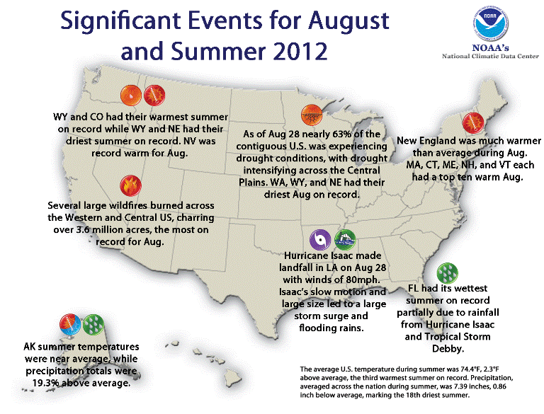
National several weather events, Summer 2012 (credit: NOAA)
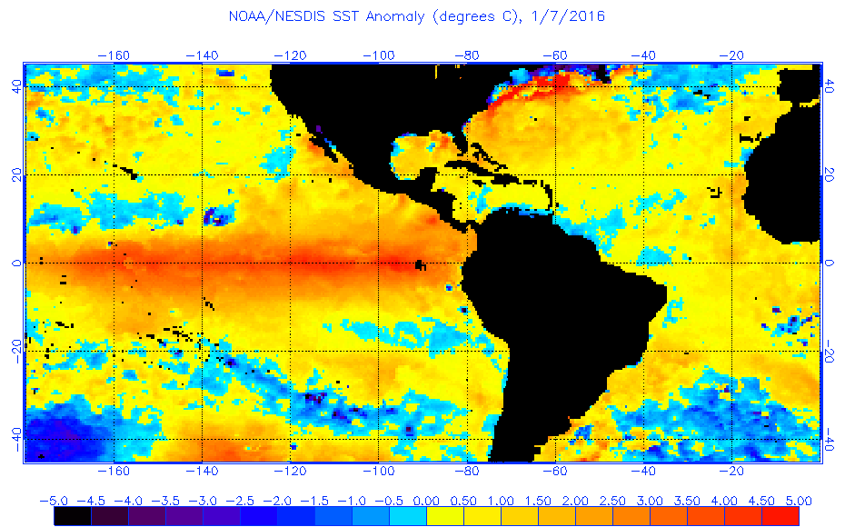
An exceptional level of water vapor is being carried by the atmosphere and high temperatures in the Pacific Ocean has creating surface temperature anomalies. Higher water temperatures allow more moisture to evaporate. The warmer atmosphere carries the moisture which is available to drive extreme storms, rainfall, and flooding events.

Pacific Ocean surface temperature anomalies, August 2016 (credit: NOAA)
The diversity of anomalous weather and climate related events has been cataloged by many media organizations but the BBC showed some of strangest ones, even "a rain of spiders".
One researcher noted that climate change has altered what was once considered to be normal:
"extreme events are more likely with the heating of the planet now and expect anywhere to get a lot more to happen now…"
WHB