Rising Tides
Wave action La Jolla, California (credit: Wikicommons)
Like any wise mariner, we should be pay more attention to the tides, particularly when they are rising. The Jet Propulsion Lab (JPL) at CalTech has been using radar and other remote sensing data to monitor the oceans and rising sea levels for multiple decades. The news from JPL is not good.
According to the Lab, the oceans have been absorbing approximately 90% of the excess heat generated by the carbon dioxide (CO2) that is warming the Earth's atmosphere. This heat increases water volume; increases the strength of storms; melts polar ice and glaciers on Greenland and Antarctica; and has resulted in rising sea levels around the world. In the past 30 years, sea level has increased at the rate of 3.2mm/year since 1993. JPL graphed this 3-decade long growth.
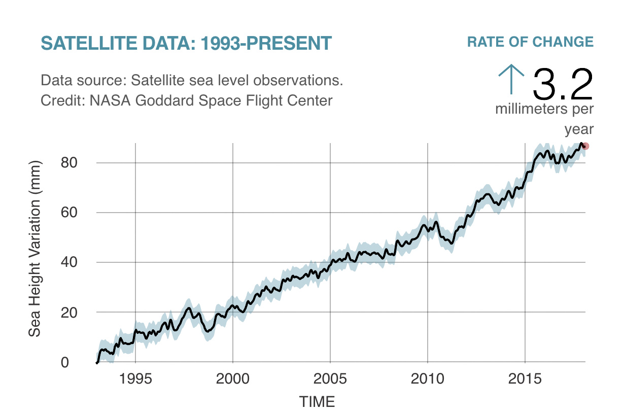
Sea level rise, 1993-present day (credit: JPL)
One of the newer satellites used in monitoring the oceans, the Sentinel-6, gathers even more granular environmental measurements. The US and European collaboration measures sea level surface heights and other key environmental features such as wind speeds that can affect the height of waves. The big data sets from the satellite are received, analyzed, and compared with previous ocean measurements. This data greatly assists in the improvement of oceanic and land-based weather forecasts.
The National Oceanic and Atmospheric Administration (NOAA) has three geo-stationary Earth monitoring satellites in their GOES series that provide additional information on a bi-hourly basis. As one NOAA manager said: In a changing climate, it is a great achievement all this data is available.”
The old adage of: 'rising tides, sailors be wise' is now more relevant than ever. WHB