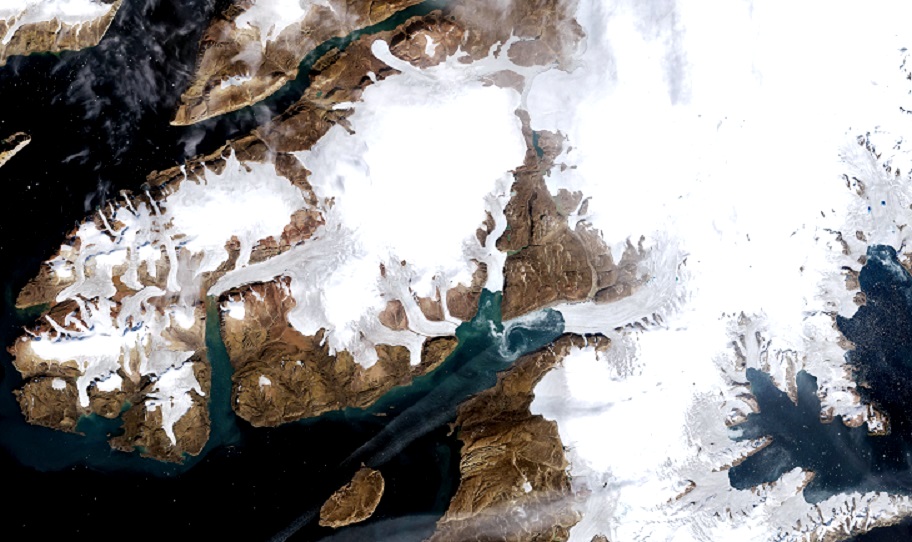
Greenland Melting Accelerates
Greenland west coast ice streams, 3-27-2015 (credit: ESA)
Greenland is melting, faster than ever. The European Space Agency (ESA) and NASA have created a data visualization to show extent of this loss in ice mass from 2018 to 2024.
According to the ESA, the new animation shows the total elevation changes measured across the Greenland ice sheet during this six-year period. Utilizing space-based radar and laser elevation sensors on the ESA's CryoSat and NASA’s ICESat-2 polar satellite missions, the loss in Greenland ice was accurately determined. The animation illustrates changes averaged over the ice sheet’s interior and its margins. Blue tones represents data from the ESA with the red tones representing NASA data. Part of the dual measurements were to determine if the accuracy of their measurements matched.
The animation shows thinning is greater along the coastal margins of the massive icy island than at its interior. Examples of extreme thinning were noted at the Jakobshavn glacier located on the western coast of Greenland. That glacier was featured in the dramatic climate change documentary Chasing Ice where ground-based, time-lapse photography was used to record ice-calving events from Jakobshavn as they occurred.
Previously, NASA investigations had shown that glaciers along the coastal zones, while relatively small and disconnected from the main ice sheet and accounting for just a small proportion of Greenland’s ice-covered area (about 4%), produced for about 11% of the island’s ice loss. That makes these glaciers over-sized contributors to sea level rise from their meltwater.
Previously publishing in Geophysical Research Letters the NASA scientists showed that northwest Greenland glaciers had been losing approximately 4-8 billion tons of ice/year in recent decades amid accelerated atmospheric warming. That is more than the peripheral glaciers in southeast and southwest Greenland were losing, but less than in north Greenland, where peripheral glaciers have lost much as 29 billion tons/year since the early 2000s.


Satellite images of Northwest Greenland coastline captured on 9-2-1973 and 8-20-2022 landscape comparisions (credit: NASA)
The ESA video reveals how the edges of the ice sheet are melting more rapidly than the center, particularly at spots where glaciers flow into the open ocean. The new research finds that Greenland lost 563 cubic miles (2,347 cubic kilometers) of ice, which is enough to fill Lake Victoria, Africa's largest lake during the six-year period. The complete technical details from the latest ESA/NASA research was just published by Geophysical Research Letters as well. WHB