Tonga Volcano
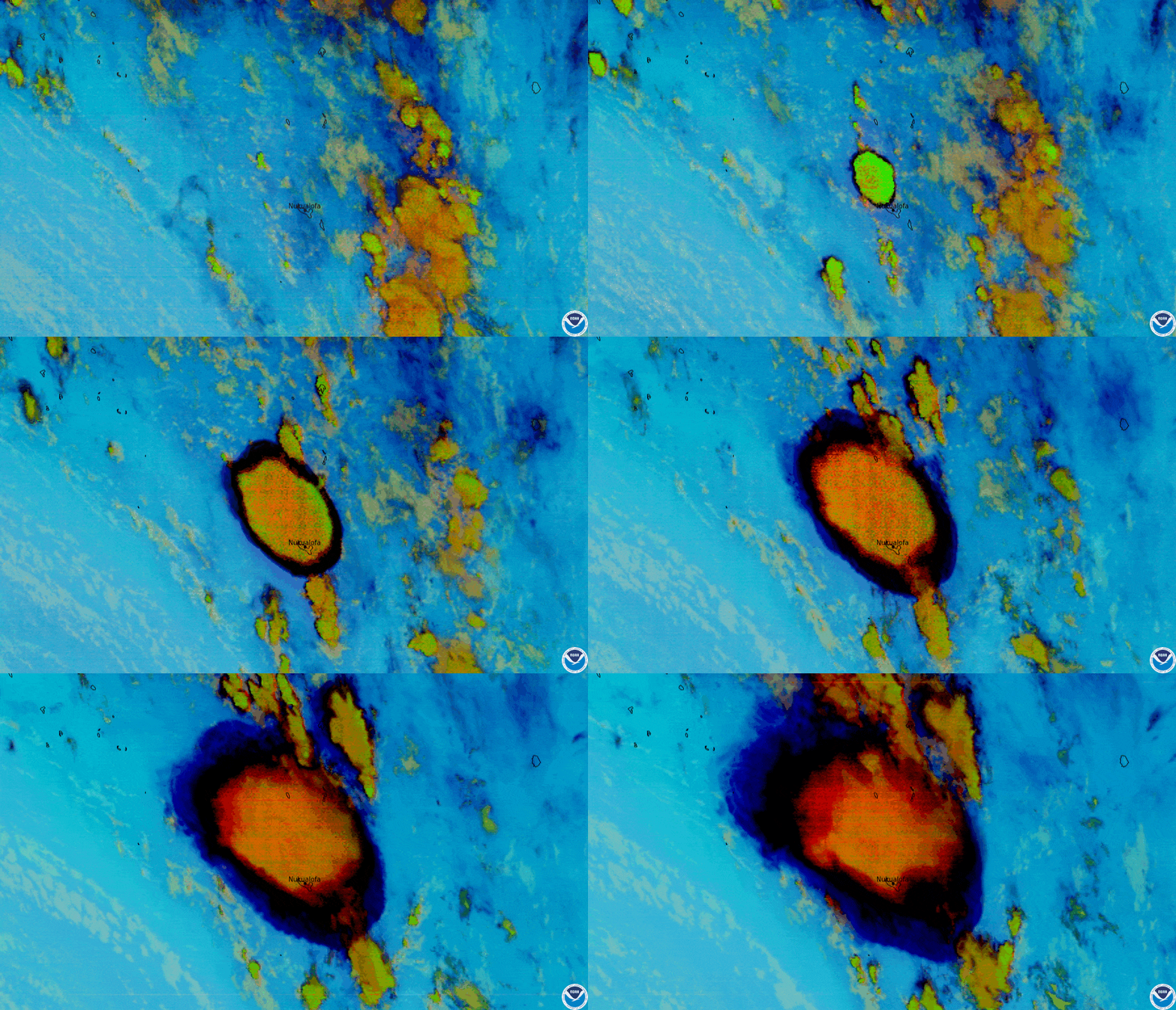
Volcanic eruption of undersea volcano near Tonga (credit: Japan Meteorological Agency)
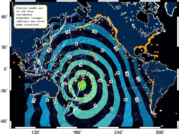
An undersea volcano violently exploded near the island nation of Tonga. Remote sensing satellites with cameras and other sensors captured the Hunga volcano as it unfolded. The eruption was so powerful undersea pulses were felt throughout the Pacific Ocean region. Tsunami warnings were issued along North America's entire west coast and large waves appeared in Australia.
According to the National Oceanic and Atmospheric Administration (NOAA), the eruption had a radius of 180 miles and sent ash, steam, and gas nearly 20 miles into the air. The explosion produced an estimated 7.4 scale earthquake shockwaves felt across the Pacific. NOAA's Earth-monitoring GOES-West geostationary satellite, along with other remote sensing space robots, recorded the eruption in great photographic and environmental monitoring details. The island nation of Tonga experienced flooding and property damages from the ash and tsunami with the extent still being determined. Hunga continues erupting and a new island in the Pacific is now forming in 'real time'.
NOAA's data visualizations provide a measure to the power of the Hunga eruption. WHB

GOES infrared sensor photo-animation, Hunga volcano explosion, 1-14-2022 (credit: GOES satellite)


Tonga Hunga volcano eruption 1-14-2022 (credit: Tonga Online) and Pacific Ocean shock-wave data graphic (credit: NOAA)