Watching An Ice-shelf Collapse
Photo-map of the Larsen-C ice shelf with 100 mile crack, 2017 (credit: NASA)
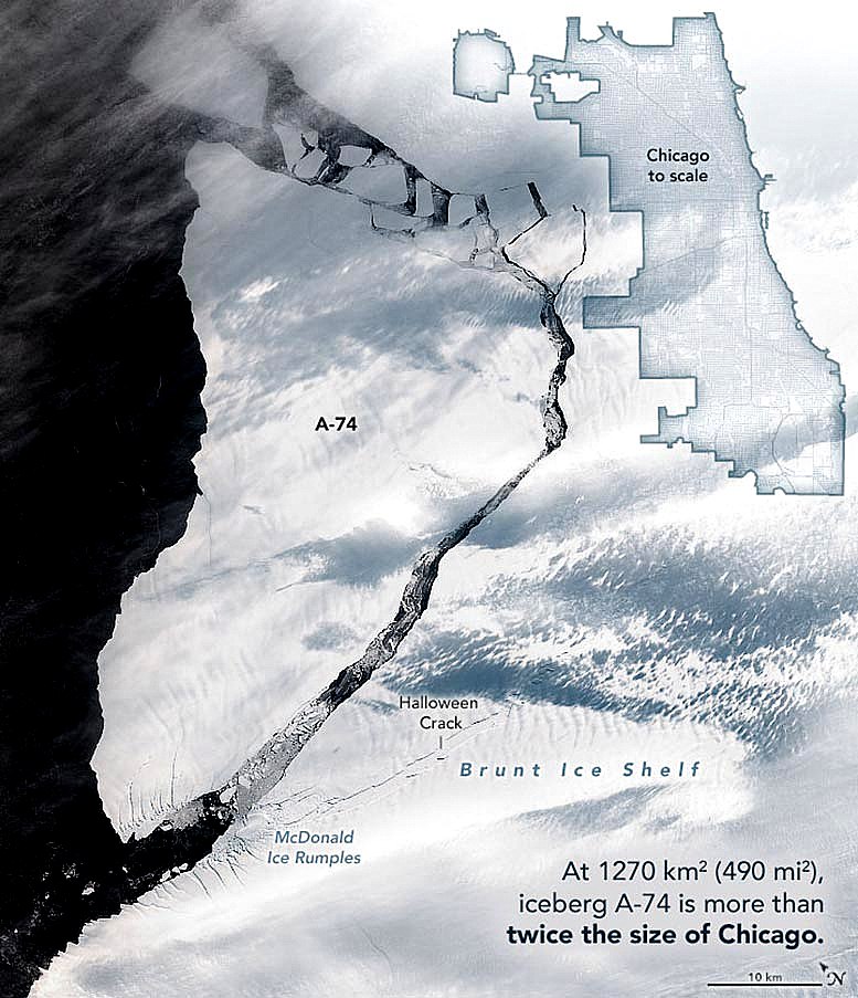
In what what was one of the last photo-maps of its kind, NASA released a remote sensing image of Larsen-C ice-shelf on the Antarctic Peninsula nearing collapse in March 2017. A crack in the ice was then more than 100 miles long and has been monitored remotely ever since. The shelf has now fully separated from the Antarctic Peninsula. The resulting iceberg is larger than Chicago or the state of Delaware and will float into the southern ocean to eventually fragment into pieces. The European Space Agency (ESA) has released a photograph confirming the detachment.
The removal of such a large mass of ice, which acts like a "plug" for glaciers inland, could result in accleration of the flow of glaciers more rapidly into the ocean. Climate change has caused temperatures to rise very rapidly over the peninsula and contributed to the rate of collapse.
Larsen-C ice-shelf detaches, 3-1-2021 (credit: ESA Sentinel-satellite)
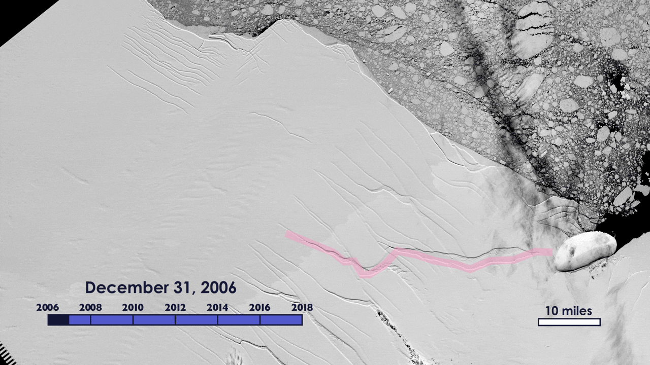
The UK-based research organization Project MIDAS has monitored the progress of the Larsen-C crack and related glacial dynamics along with the British Antarctic Survey. A 2006-2021 timelapse photo-animation of the growing crack and the ice-shelf's collapse is now complete. WHB