Bombs Away

Atmospheric river data animation updated, 11-20-24 (credit: NOAA GOES-18)
A massive atmospheric river has reached the West Coast of the United States and Canada. It became a 'bomb cyclone' that rapidly grew in strength within 24 hours as it approached the coast. The process of bombogenesis can produce enormous amounts of rainfall depending on where it reaches land. The National Oceanic and Atmospheric Administration (NOAA) has been following the storm's development with its GOES-18 environmental monitoring satellite. The remote sensing scientific instrument is geostationary in space and provides coverage of the Western Hemisphere, much of the US, the Pacific Ocean, Alaska, and Hawaii.
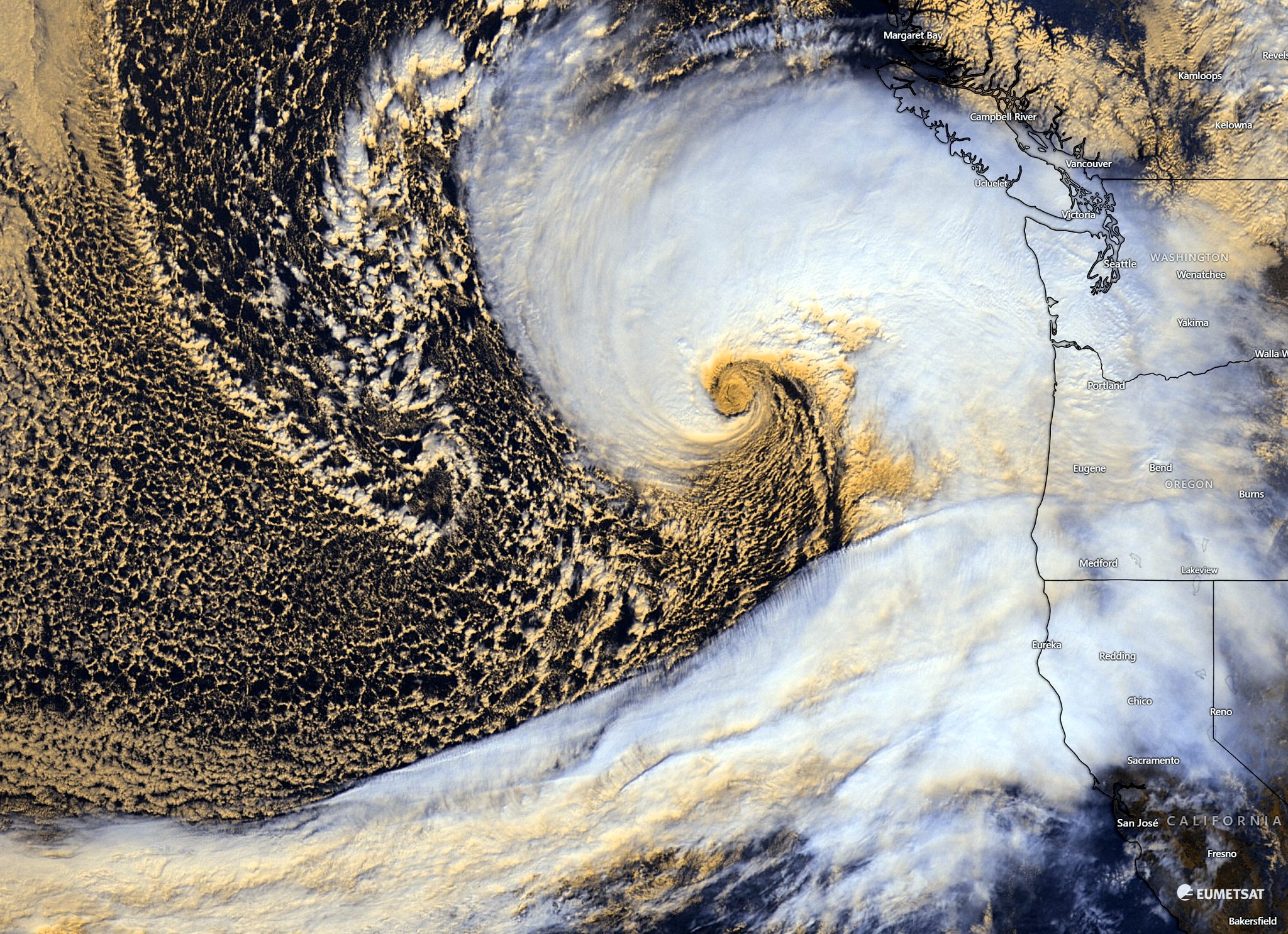
According to NOAA, the giant weather system is bringing strong winds, heavy rain, and mountain snows to the Pacific Northwest risking floods, landslides, and flowing debris. The Agency's photo animation loop shows the low-pressure system swirling about 300 miles off the coast of Washington as it sucks in atmospheric moisture from across the Pacific Ocean. The system has already produced hurricane-force winds, loss of electric power, caused extensive tree damage, and triggered blizzards in the Cascade Mountains. This 'bomb cyclone' is historically intense due to the central atmospheric pressure that dramatically dropped, intensifying the storm.
A meteorological organization based in Europe also captured a dramatic image of the extreme storm system stretching from the Gulf of Alaska. This 'bombed out' situation may extend down into Califoria considering all the heavy moisture now being carried by this huge weather system. WHB

Atmospheric river heading towards the Pacific Coast (credit: EUMETSAT/Winds.com)