Michale's Rainfall
Hurricane Michael, 10-8-2018 (credit: NASA/USGS/NOAA GOES-East satellite)
Hurricane Michael is history but data gathered during the super-storm continues being interpreted.
The US Geological Survey has animated rainfall data measurements gathered during the hurricane's movement from making landfall in Florida until it crossed into the Atlantic Ocean off the coast of Virginia. According to the Agency,
"while Hurricane Michael's winds and storm surge were devastating, the rains also left their mark, triggering flash floods and high waters all along the storm's track."
The rainfall data was gathering by USGS rain gauges stationed throughout the Southeast region along the super-storm's path. In the animation, total rainfall ranged from under 1 inch (pale white) to over 8 inches (dark purple) while flood waters were represented by two shades of blue: under flood stage (light blue) above flood stage (dark blue).
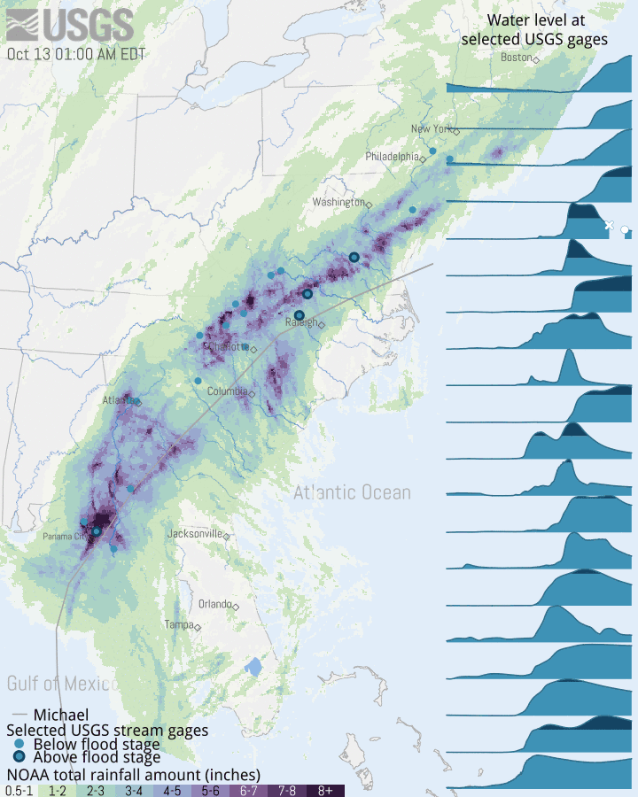
Hurricane Michael rainfall totals and animated data visualization (credit: USGS)
Data visualizations are powerful tools to illustrate the extent of an extreme weather events like hurricanes. The insurance costs for damages are now estimated in the billions of dollars, another measure of how climate change amplifies storm outcomes.
WHB