Night Vision
Larsen-C Detachment Map, July 12, 2017 (credit: Project MIDAS)
Rapid developments of a crack on the Antarctic Peninsula's Larsen-C ice-sheet have led to a massive iceberg separating and drift away. The iceberg is as large as the state of Delaware.
How did glaciologists and other NASA researchers know when the massive berg would separate from theice shelf in the total darkness of Antarctica's winter? They used cameras set with thermal infrared sensors (TIRS) on the Earth observing Landsat-8 satellite. The camera's IR sensors are based on applying physics to detect heat in two IR wavelengths. The technology can separate the temperature of the Earth’s surface from that of the surrounding atmosphere. Scientists at the Goddard Spaceflight Center then used the remote sensing technology to watch the Larsen-C ice shelf crack as it completely separated. In the perpetual darkness of Antarctica’s winter, Landsat's thermal infrared camera effectively provided them with 'night vision'.
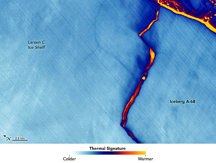
Thermal IR scan of Larsen-C Iceshelf crack (credit: NASA, USGS, Landsat-8)
Because the satellite's camera can "see" an ice crack expand from its beginning to its end, the thermal infrared scanner will now be used to observe other Antarctic ice shelves for any new cracks. It is an essential tool for helping to track ice dynamics as the climate warms at the southern pole.
WHB